


🌐 INTERNATIONAL ORBITAL SUSTAINABILITY
& DECONTAMINATION PROTOCOL (IOSDP)
Framework for Responsible Use of Earth Orbits and Future Solar System Resource Development
Version 1.0 – Draft for International Adoption
Date: 2025
Scope: Earth Orbits (LEO · MEO · GEO) – Extendable to Cislunar Space
ARTICLE 1 — PURPOSE AND SCOPE
- This Protocol establishes a global framework for the sustainable, safe, and efficient use of orbital space, with the objectives of:
- Preventing orbital congestion and collision cascades.
- Preserving long-term access to space for all humanity.
- Enabling future large-scale space infrastructure and resource utilization.
- The Protocol applies to:
- All space objects launched into Earth orbit.
- All operators, public or private, under the jurisdiction of States Parties.
- This Protocol is technological, environmental, and operational in nature and does not regulate political or military doctrines.
ARTICLE 2 — DEFINITIONS
For the purposes of this Protocol:
- LEO (Low Earth Orbit): 160–2,000 km altitude.
- MEO (Medium Earth Orbit): 2,000–35,786 km altitude.
- GEO (Geostationary Orbit): Circular orbit at 35,786 km above Earth’s equator with Earth-rotation synchronization.
- Space Object: Any payload, satellite, stage, or component placed into orbit.
- Orbital Debris: Any non-functional human-made object in orbit.
- End-of-Life (EOL): The planned disposal phase of a space object.
- ADR (Active Debris Removal): Technologies and operations intended to remove debris from orbit.
- STM (Space Traffic Management): Coordinated systems for collision avoidance, data sharing, and orbital governance.
ARTICLE 3 — PRINCIPLE OF ORBITAL COMMON GOOD
- Earth orbit is recognized as a finite and critical shared operational environment.
- All activities shall:
- Avoid irreversible degradation of orbital shells.
- Internalize environmental and collision-risk externalities.
- No operator may claim exclusive or permanent rights over any orbital region.
ARTICLE 4 — MULTI-LAYER ORBITAL ARCHITECTURE PRINCIPLE
- States Parties recognize the necessity of a multi-layer orbital architecture, assigning functions according to orbital characteristics:
- LEO: Low-latency, time-sensitive services under strict density and disposal rules.
- MEO: Regional coverage, navigation, and intermediate-latency services.
- GEO: Global broadcast, backhaul, stable energy transmission, and long-term infrastructure.
- Services not requiring low latency should be progressively migrated from LEO to MEO/GEO where technically feasible.
ARTICLE 5 — LIMITATION OF ORBITAL DENSITY IN LEO
- States Parties shall establish maximum density thresholds per LEO orbital shell based on:
- Collision probability.
- Debris generation risk.
- “Intensive deployment” is defined as:
- Exceeding annually defined satellite counts per shell, or
- Increasing collision risk beyond scientifically established thresholds.
- Launch licenses shall be conditional on compliance with these limits.
ARTICLE 6 — MANDATORY END-OF-LIFE DISPOSAL
- All LEO space objects must:
- Be safely de-orbited within a maximum of 5 years after end-of-mission, or
- Re-enter Earth’s atmosphere in a controlled manner.
- GEO satellites must:
- Be transferred to a graveyard orbit according to internationally agreed parameters.
- Passivation of all energy sources is mandatory to prevent post-mission fragmentation.
ARTICLE 7 — ACTIVE DEBRIS REMOVAL FUND (ADR FUND)
- An International Orbital Decontamination Fund is established.
- Contributions are calculated based on:
- Number of satellites launched.
- Total mass placed in orbit.
- Orbital shell occupancy duration.
- The Fund finances:
- Verified ADR missions.
- Development of debris-neutralization technologies.
- Priority is given to debris with the highest collision-risk index.
ARTICLE 8 — SPACE TRAFFIC MANAGEMENT (STM) OBLIGATIONS
- All operators must:
- Share precise orbital data and maneuver plans.
- Participate in coordinated conjunction avoidance systems.
- Failure to share accurate data constitutes a licensing violation.
- States Parties shall harmonize STM standards through a central coordination mechanism.
ARTICLE 9 — ROCKET PROPULSION AND ATMOSPHERIC PROTECTION
- Launch operators must comply with measurement, reporting, and verification (MRV) standards for:
- Black carbon emissions.
- Ozone-depleting compounds.
- Progressive emission thresholds shall be established per kilogram of payload delivered to orbit.
- High-impact propulsion systems shall be subject to:
- Environmental surcharges, or
- Phased replacement timelines.
ARTICLE 10 — COMPLIANCE AND ENFORCEMENT
- Compliance with this Protocol is a condition for national launch licensing.
- Sanctions may include:
- Financial penalties.
- Suspension of launch authorizations.
- Loss of access to orbital slots or spectrum coordination.
- Enforcement is contractual and regulatory, not punitive or military.
ARTICLE 11 — EXTENSION TO CISLUNAR AND SOLAR SYSTEM OPERATIONS
- The principles of this Protocol shall apply by extension to:
- Cislunar space.
- Permanent orbital infrastructure.
- Resource utilization beyond Earth orbit shall:
- Respect sustainability principles.
- Avoid monopolization of strategic trajectories or locations.
- Separate protocols may regulate extraction, processing, and transport of extraterrestrial resources.
ARTICLE 12 — REVIEW AND EVOLUTION
- This Protocol shall be reviewed every 24 months.
- Scientific data, collision statistics, and technological evolution shall guide revisions.
- Amendments enter into force upon ratification by participating States Parties.
FINAL DECLARATION
This Protocol affirms that orbital space is not infinite and that intelligence, coordination, and foresight are the only path to sustainable expansion beyond Earth.
Humanity’s future in space depends not on speed,
but on precision, responsibility, and long-term vision.
📎 IOSDP — TECHNICAL ANNEX A
Orbital Architecture, Risk, Thresholds & Integration with LaserSat / GEOStation
Version A1.0 (Engineering Draft)
A.1 Conceptos técnicos clave (definiciones operativas)
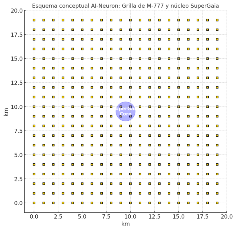
A.1.1 Capas orbitales
- LEO: 160–2.000 km
- MEO: 2.000–35.786 km
- GEO: 35.786 km (geoestacionaria)
A.1.2 “Baja entropía orbital”
En este protocolo, “baja entropía” significa:
- menos objetos para mismo servicio,
- trayectorias estables y previsibles,
- menos maniobras y menos cruces,
- baja tasa de fragmentación,
- alta trazabilidad y gobernanza STM.
A.1.3 Métricas núcleo
- Latencia (ms)
- Cobertura / satélite
- Riesgo de conjunción (Pc)
- Riesgo anual de colisión por shell (R_shell)
- Tiempo de permanencia post-misión (EOL residency)
- Tasa de fragmentación / fallos
- Costo de disposición (deorbit/transfer/graveyard)
A.2 Comparación técnica LEO vs MEO vs GEO (datos y ecuaciones)
A.2.1 Latencia: por qué LEO es irreemplazable para “real-time”
La latencia mínima física está dominada por la distancia (c) y el “camino” real (aire + rutas + switching).
Aproximación simple:
- Distancia ida-y-vuelta ≈ 2 × altura (para estimación mínima)
- Tiempo ≈ distancia / c
- c ≈ 300.000 km/s
LEO (550 km típico):
- RTD ≈ 2×550 = 1.100 km
- t ≈ 1.100 / 300.000 = 0,0037 s = 3,7 ms (mínimo físico, sin red)
GEO (35.786 km):
- RTD ≈ 71.572 km
- t ≈ 71.572 / 300.000 = 0,238 s = 238 ms (mínimo físico, sin red)
En la práctica, sumando ruteo y overhead:
- LEO servicio: decenas de ms
- GEO servicio: cientos de ms
Conclusión ejecutiva:
- LEO es “capacidad de baja latencia”.
- GEO es “capacidad de estabilidad e infraestructura”.
A.2.2 Cobertura: cuántos satélites para cobertura global
GEO:
- Con 3 satélites separados ~120° se logra “casi global” (limitaciones en latitudes extremas).
- Ventaja: pocos activos, muy predecibles.
LEO:
- Cobertura global continua requiere constelaciones (número depende de altura, inclinación, beams, enlaces intersat).
- Ventaja: latencia baja; desventaja: escala en número y congestión.
MEO:
- Intermedio: menos satélites que LEO para cobertura amplia; latencia menor que GEO.
A.2.3 Velocidad orbital y energía (impacto en colisiones)
A mayor altura, menor velocidad orbital, pero el factor crítico es velocidad relativa en intersecciones de planos.
Órdenes de magnitud:
- LEO: ~7,5 km/s
- MEO: ~3–5 km/s
- GEO: ~3,1 km/s (aprox. circular)
Colisiones: la energía cinética crece con v².
→ En LEO, colisiones pueden fragmentar masivamente y alimentar cascadas.
A.3 Saturación y riesgo: modelo de ingeniería “tratado-compatible”
A.3.1 Qué mide el riesgo (sin discutir filosofía)
Para IOSDP, el riesgo se expresa en dos niveles:
- Pc (probabilidad de conjunción peligrosa) por evento
- R_shell (riesgo anual agregado por shell)
Esto permite crear umbrales y licencias.
A.3.2 Modelo simplificado de conjunciones
Una forma estándar (simplificada) de aproximar riesgo de conjunción es:
- Definir un radio de “hard-body” efectivo + incertidumbre (σ)
- Calcular probabilidad de que dos objetos entren en el volumen de colisión
En operación STM real se usan:
- estimación de órbita + covarianzas,
- probabilidad Pc por aproximación,
- maniobras si Pc supera umbral.
Lo importante para el Protocolo:
- exigir Pc-reporting y Pc-thresholds.
A.3.3 “Densidad crítica” por shell (umbral para licenciamiento)
Definimos un shell (ej.: 500–600 km, 600–700 km, etc.) y lo regulamos por:
- N_shell: número de objetos relevantes (activos + grandes inactivos)
- Crossings: cuántos planos/inclinaciones cruzan ese shell
- Manoeuvre capacity: qué % de objetos pueden maniobrar
- EOL compliance: qué % retira en plazo
Umbral operativo (ejemplo de norma):
- Si EOL compliance < X%, el shell entra en “estado restringido”:
- cupo anual reducido,
- tasa ADR aumentada,
- nuevas licencias condicionadas a garantías adicionales.
Esto es más fuerte que “prohibir LEO”: crea gobernanza adaptativa.
A.4 EOL y disposición: por qué “5 años” es una palanca dura
A.4.1 Residencia post-misión
Cada satélite muerto es “riesgo acumulativo” por años.
Reducir residencia baja:
- N_shell efectivo
- conjunciones futuras
- probabilidad de cascada
A.4.2 EOL en GEO
En GEO no se deorbita: se manda a graveyard orbit (cementerio).
Clave:
- evitar interferencia con slots activos,
- garantizar pasivación (nada que explote).
A.5 ADR Fund: fórmula de contribución (simple, defendible, auditable)
A.5.1 Contribución por operador (base)
Propuesta de contribución anual:
Fee_operator = α·N + β·M + γ·T + δ·RiskIndex
Donde:
- N = número de satélites lanzados ese año
- M = masa total a órbita (kg)
- T = “ocupación” (satélite·año por shell)
- RiskIndex = función de densidad y Pc agregado en shells usados
- αβγδ se calibran por comité técnico
Ventaja:
- auditable, proporcional, internaliza externalidades.
A.5.2 Priorización de objetos para remoción (ADR scheduling)
Definimos un Debris Priority Score (DPS):
DPS = w1·Mass + w2·CrossSection + w3·CollisionExposure + w4·FragmentationPotential − w5·RemovalDifficulty
- CollisionExposure: cuántas conjunciones peligrosas esperadas por año
- FragmentationPotential: energía almacenada, materiales, probabilidad de ruptura
- RemovalDifficulty: accesibilidad orbital, rotación, costo energético
ADR financia primero los objetos de mayor DPS.
A.6 Propulsión y atmósfera: cómo regular sin “prohibir por slogan”
A.6.1 MRV (Measurement/Reporting/Verification)
Se exige por lanzamiento:
- tipo de propulsor,
- masa de propelente,
- emisiones estimadas,
- reporte estandarizado.
A.6.2 Tasa ambiental por kg a órbita
EcoFee = k · (ImpactFactor) · (kg_payload_to_orbit)
ImpactFactor clasifica:
- sólidos (alúmina),
- kerosene (soot),
- hipergólicos,
- metano,
- hidrógeno.
No hace falta “ganar la pelea ideológica”: se hace con pricing + transición.
A.7 Integración directa con LaserSat / GEOStation (encaje del “stack”)
A.7.1 LaserSat como capa “infraestable”
LaserSat encaja mejor como:
- capa GEO/MEO: estabilidad angular, enlaces previsibles, menor necesidad de handovers
- backhaul global y nodos de distribución
Punto técnico: transmisión direccional (láser/microondas) requiere:
- geometría estable,
- “clean corridors” (baja probabilidad de intersección con objetos),
- coordinación STM a nivel infraestructura.
LEO “swarm” hace más difícil sostener corredores limpios, por eso IOSDP propone:
- migración de servicios no-latency-critical a MEO/GEO
- LEO bajo reglas estrictas y cupos.
A.7.2 GEOStation como “plataforma de infraestructura”
GEOStation no se vende como “matar LEO”. Se vende como:
- columna vertebral estable:
- comunicaciones,
- energía,
- coordinación de tráfico,
- soporte a ascensores/infra de largo horizonte (futuro).
A.7.3 LaserDron: dependencia indirecta del IOSDP
LaserDron opera en atmósfera, pero se beneficia de:
- sincronización y clock estable,
- backhaul robusto,
- redes resilientes.
Arquitectura recomendada:
- LaserDron control/coord local (edge) + redundancia satelital (GEO/MEO)
- LEO sólo para servicios ultra low-latency si es imprescindible.
A.8 Umbrales recomendados (para anexar a licencias)
A.8.1 Umbrales STM
- Umbral Pc para maniobra (definido por comité, por clase de satélite)
- obligación de compartir efemérides y planes de maniobra
A.8.2 Umbral de “shell health”
Shell entra en estado:
- Green: libre expansión controlada
- Yellow: cupos y fees aumentan
- Red: congelamiento parcial de nuevas inserciones salvo reemplazos con garantías ADR/EOL
Esto convierte el protocolo en un “sistema vivo” y no en un manifiesto.
A.9 Roadmap técnico de transición (sin apagar el mundo)
- STM + data sharing obligatorio (inmediato)
- EOL ≤5 años en LEO (ventana de implementación)
- ADR Fund operativo (financia primeras remociones)
- Shell health gating (cupos por densidad)
- Migración funcional: broadcast/backhaul → MEO/GEO
- Infraestable: GEOStation + LaserSat como backbone
A.10 Anexo de “claims control” (para comunicación institucional)
Para evitar rechazo:
- reemplazar “técnicamente validado” por:
- “en fase de ingeniería y validación por pilotos”
- reemplazar “desactivación LEO” por:
- “decongestión + gobernanza STM + migración funcional”
- evitar números rígidos (85% etc.) salvo en estudios firmados
© 2026 SpaceArch Solutions International, LLC, Miami, Florida, USA. All rights reserved. No part of this document may be reproduced, distributed, or transmitted in any form without prior written permission.