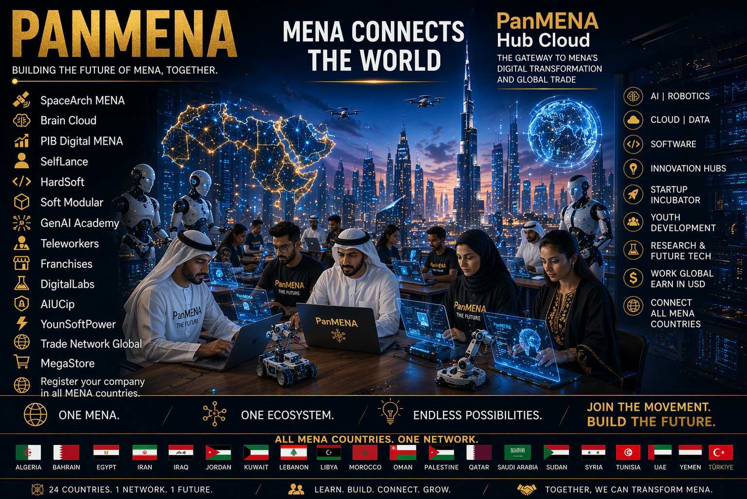


The Continental Digital Map is one of the central tools of PanMENA Hub Cloud.
Its objective is to visually connect all 24 MENA countries inside one digital network and show, in real time, the growth of the PanMENA ecosystem.
The map is not only geographic.
It is a living map of opportunities, companies, teleworkers, startups, DigitalLabs, innovation hubs, courses, franchises and projects across the Middle East and North Africa.
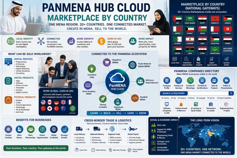
24 Countries. One Interactive Map. One Digital MENA.
🌍 ONE INTERACTIVE MAP FOR ALL MENA
The Continental Digital Map allows users to see all MENA countries connected inside the same system.
Every country appears as an active node inside the network.
When users click on a country, they can access:
• Country profile
• National portal
• Registered companies
• Teleworkers Network
• DigitalLabs and innovation hubs
• Courses and certifications
• Trade opportunities
• Startup ecosystem
• Franchises and business opportunities
• MegaStore and Trade Network Global
• Company registration system
Examples of countries visible on the map include:
• Saudi Arabia
• United Arab Emirates
• Egypt
• Morocco
• Jordan
• Qatar
• Oman
• Kuwait
• Bahrain
• Tunisia
• Lebanon
• Algeria
Each country maintains its own local information while remaining connected to the larger PanMENA system.
🏙️ COUNTRY AND CITY NODES
The map can display not only countries, but also major city nodes and regional hubs.
Examples include:
• Dubai
• Riyadh
• Cairo
• Casablanca
• Amman
• Doha
• Kuwait City
• Muscat
• Tunis
• Beirut
Each city can become a center for:
• Teleworkers
• DigitalLabs
• Startups
• GenAI Academy
• SelfLance teams
• Innovation hubs
• Regional business centers
This allows PanMENA to grow step by step, from the regional level down to local cities and communities.
🚀 WHAT USERS CAN SEE ON THE MAP
The Continental Digital Map can include multiple interactive layers:
BUSINESS LAYER
• Registered companies
• Startups
• Franchises
• Investors and business partners
• MegaStore sellers
• Trade Network Global connections
TELEWORKERS LAYER
• Number of teleworkers by country
• Available skills
• Remote work opportunities
• Teams and freelancers
• Demand for digital services
GENAI ACADEMY LAYER
• Available courses
• Local academies
• Certifications
• Student communities
• AI, business and coding programs
DIGITALLABS LAYER
• Active labs
• Technology projects
• AI, software and robotics teams
• Innovation hubs
• Startup incubators
SELFLANCE LAYER
• Developers
• Designers
• Engineers
• Sales and business teams
• Modular software projects
BRAIN CLOUD LAYER
• Active countries
• Growth indicators
• Digital MENA GDP participation
• Collaboration between countries
• Regional expansion
📈 LIVE GROWTH INDICATORS
The map can also display the evolution of PanMENA Hub Cloud through real-time indicators such as:
• Number of countries connected
• Number of registered companies
• Number of teleworkers
• Number of students and courses
• Number of DigitalLabs
• Number of startups and projects
• Number of franchises
• Total Digital MENA GDP generated
This transforms the map into a visual dashboard of regional progress.
🌐 EXAMPLE OF A COUNTRY PROFILE
If a user clicks on Saudi Arabia, the map could display:
Saudi Arabia
• 120 Registered Companies
• 850 Teleworkers
• 8 DigitalLabs
• 35 Courses
• 22 Startups
• Main sectors: AI, Smart Cities, Education, Technology, Tourism
If a user clicks on Morocco, the map could display:
Morocco
• 45 Registered Companies
• 300 Teleworkers
• 4 DigitalLabs
• 18 Courses
• 10 Startups
• Main sectors: Technology, Digital Services, Tourism, Trade
The same structure can be repeated for every country in the region.
🤝 CROSS-BORDER CONNECTIONS
The map can also show how countries collaborate with each other.
Examples:
• Saudi Arabia connected with UAE for AI and startup investment
• Egypt connected with Jordan for software and education
• Morocco connected with Qatar for digital marketing and trade
• Tunisia connected with Saudi Arabia for telework and GenAI Academy
• UAE connected with all MENA countries through DigitalLabs and business expansion
These collaborations can appear visually as digital routes and lines across the map.
This helps users understand that PanMENA is not a group of isolated countries.
It is one integrated regional network.
🧠 A MAP OF TALENT, BUSINESS & OPPORTUNITY
The Continental Digital Map is not only a geographic tool.
It is a map of:
• Talent
• Knowledge
• Business
• Innovation
• Collaboration
• Shared growth
Every new company, teleworker, course, startup or DigitalLab becomes visible on the map and increases the value of the entire system.
⚡ FUTURE EXPANSION
As PanMENA grows, the Continental Digital Map can evolve to connect with:
• PanAfrica
• PanLatam
• PanAsia
This would create the first global network of continental Brain Clouds connected through one shared digital system.
Dubai, Miami, Mar del Plata, Cairo, Riyadh and Casablanca can become strategic bridges between regions.
🌟 FINAL VISION
The Continental Digital Map is the visual heart of PanMENA Hub Cloud.
It shows that the Middle East and North Africa is no longer fragmented.
24 countries become one network.
24 countries become one Digital MENA.